Monday, September 30, 2019

Blanding to Monument Valley

It’s only a 1-1/2 hour drive from Blanding to Monument Valley but there are plenty of things to see on this drive. Comb Ridge stretches 80 miles and is very distinctive.


Bluff Fort is rather amazing. It’s a museum with both artifacts and recreations that includes a movie (excellent and very professional), some indoor exhibits, and a gift shop. But the outdoor exhibits are amazing. And the whole thing is free!

Back in 1879-1880, a group of Mormons traveled a new path (now called the Hole in the Rock Trail) to settle a new town of Bluff. Unfortunately, they didn’t realize the difficulty of terrain with canyons, mountains, and rivers. The most difficult portion required blasting rocks with black powder plus plenty of hard labor. One of the original wagons is on display.
 
Bluff Fort has all kinds of exhibits including Navaho  and Ute homes, lots of wagons, a water wheel, and a camp set-up.


The biggest thing is the homes of the settlers (~11 of the homes). Each of them had period artifacts decorated by descendants of the actual family. 

Plus, there were plenty of stories about life back then. For instance, the co-op store/dance hall had a safe. A bank robber used dynamite to break the safe but instead took down the building and he died in the blast. Another story involved a trade deal that almost caused a battle with the local Native Americans. I liked the simple picture of Sarah Perkins with her 9 daughters and her only son sitting forlornly in the background. It would be easy to spend hours here.

Our next stop was the Sand Island Petroglyphs. The panel isn’t very far off the road. We were lucky to be able to look at the petroglyphs before a bus full of tourists stopped. A quick comment about petroglyph porn, at least two of the figures in this picture were well-endowed.

There are popular Native American art figures like Kokopelli or a Hopi flute player that you see everywhere in the west. They are particularly popular in gift shops to decorate all kinds of items. However, they are always cleaned up for current tastes while the actual depictions in petroglyphs varied in being well-endowed or not. The Edge of the Cedars has a statue of the Hopi flute player “fully endowed”. It became a major controversy where outraged citizens wanted it gone while others were fine with it. The park decided to compromise by moving it from the front of the park building to the back so it couldn’t be seen from the road. Interesting point, the statue was in front for 19 years before this became controversial.
 
Valley of the Gods is a 17-mile very rough road with some spectacular scenery. Since we only had a sedan, we drove a mile of it to an observation point. Even that mile pushed our poor car.

Goosenecks State Park doesn’t take long to see. It’s a parking lot with an immense view. This is an entrenched river meander and pretty cool! It is too big for a regular shot. Hey, this is the first panoramic picture I’ve taken!
 
 
Mexican Hat Rock is supposed to look like an upside down sombrero. The nearby town is named after it.

The Forrest Gump Point is just dangerous. In the movie, Forrest Gump decides to stop running at this gorgeous spot. There are several pull overs on both sides of the road for people to take pictures here. However, EVERYONE is stupid. We first parked in a larger parking lot. Another car pulled in and blocked the exit for everyone so they could take a picture without walking a few extra feet and then was surprised when people were upset. People walk into the road to take the perfect shot and then are surprised when cars want to drive on the road. Plus drivers come through here driving way too fast and are surprised that people are on the road. Anyhow, we survived.


Thursday, September 26, 2019

In Blanding

Right in town is the Edge of the Cedars State Park. The museum was amazing with artifacts, especially the pottery.We heard from a ranger that this pot was made using thin ropes of clay. Very thin. I thought it was amazing.

The baskets were similarly detailed construction.              

The red macaw feathers in this sash shows trade with Mexico.

Love these arrowhead points on a cord as an “ammo string”.

Outside was some ruins occupied during the 800-900’s including one where you can climb down the ladder into the lower room.
The Dinosaur Museum founded by Stephen and Sylvia Czerkas is in town. It is fascinating both as a museum and after hearing about the controversy of this museum and its founders. Around 1999, the Czerkas bought a fossil originally from China at an auction for $80,000. They studied it and wrote a paper about a new dinosaur / bird that they called Archaeoraptor as a missing link between birds and dinosaurs. The problem was that the fossil they bought was a mixture of three different remains and Czerkas didn’t want to hear that it was faked despite experts questioning the fossil. The paper was rejected by some major journals but National Geographic printed it. The whole thing became quite a scandal when it was found to be a fake.

The museum emphasizes the mixture of dinosaurs and birds that aren't exactly current science. I also read online that some of the dinosaur skeletons in this museum are assembled incorrectly / differently than scholars believe is correct.


The neat part of the museum was about dinosaur movies. Stephen Czerkas was involved in some of the earlier stop-motion movies with monsters. The exhibits on this topic were excellent like this one showing how early movies were done with foreground and backgrounds.

This one is the original model for the Brontosaurus used in King Kong.

Ruins near Blanding

We visited four Native American ruins outside of town. Butler Wash is a nice short hike.
  
A short hike on the same road took us to  the Mule Canyon Ruins. 

The Mule Canyon trail takes you to the House on Fire ruins. The hike takes you back and forth and sometimes through a wash. Luckily it was dry for our trip.

The ruins are called “on Fire” due to the reflection of the sunlight on the swirling rock of the ceiling area at a certain time of the day. We were a bit late, but we could see what they mean.

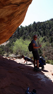
The humor to this was that there was a guy there who told us the best picture is by lying on the ground and aiming toward the ceiling area. He was right, but it was funny to see John, a German couple, and a Korean couple lying on the ground trying to get the perfect picture.


There were also some hand prints on the rocks at this stop.


Just south of Blanding is the Five Kiva Pueblo. It’s back a couple of miles from the main road but right off the parking lot.

Just for the fun of it, there’s Comb Ridge, a step-like fold in the earth. The road cuts through the ridge and is called Comb’s Cut by locals. Also in this area is a rock formation called Bears Ears. Up close I don’t see the resemblance.
Farther away I can see it (very small on the mountains in the background). You can see these “Ears” for miles and they were used as a landmark before GPS.

Next controversy (lots of them in this area) is the Bears Ears National Monument. Obama formed this monument in 2016 with 1.35 million acres. Trump reduced it 85% (!) to only 0.2 million acres in 2017. No president has made such a large reduction before. After visiting this area, I can see there are some amazing lands that are now unprotected.

Monuments near Blanding


Blanding is a good homebase to visit a couple of National Monuments in the area. We visited Natural Bridge National Monument first. After visiting the busy national parks, it was great to see available parking spaces at a park and fewer people on the trails. Natural Bridges is a 9-mile drive with multiple stops to see 3 different bridges. 

There are several trails down into the canyon where you can walk under the bridges. We did several earlier hikes that day so we skipped those trails and just went to the observation points. The next day we met a woman with her arm in a sling who hurt it on one of these trails.

There is a question of the definition of an arch and a bridge. A natural bridge was formed by a current of water like a river while an arch is formed by erosion like wind  or freezing and thawing of water in the rocks. However, over time the bridge erosion from a stream may change to other erosion if the river gets smaller or disappears. The Natural Arch and Bridge Society (NABS) group them together in their rankings.

The first bridge is called Sipapu. Apparently there is controversy here. The sign at the park says the arch is 268’ wide and “one of the largest natural bridges in the world”. Wikipedia says a laser measurement in 2007 determined it is 255’ wide making it the 13th largest arch/bridge instead of the 4th largest if it was 268’. So…big bridge but not as big as the sign says.


Another bridge (Kachina) may be considered the 20th largest. The NABS only lists a top 19  so I don’t know about the “official” standing.

The Owachomo Bridge is the thinnest bridge. The park says that it may collapse soon or in centuries as it develops cracks and further erodes.


On another day we visited Hovenweep National Monument. The ruins here are built in the 1200’s surrounding a small canyon. The buildings were built over time. There are square, round, D-shaped, single story, and multiple story buildings here. I’ve decided that no one was scared of heights that lived here. I can’t imagine building or living in these structures. There are some ruins in the canyon, but most are above.

Some of the coolest ruins are the Hovenweep Castle,

the Square Tower,
  
and the Twin Towers.


The details on all of these were fascinating. I can’t imagine the work involved!

Moab to Blanding

On our drive to Blanding we did several stops. The Hole ‘N the Rock was quite fascinating. It is a 5,000 sq.ft. house in a cave. They had tours and a couple of shops plus a zoo.

We just wandered the grounds and found all types of weird things like this lizard on the rock.

The artist who made several of the items was amazing. Here’s a jeep and details.


And a bull.


And a rock chair. Lots of bizarre things here!


At one rest stop they had a sign about this rock. It is named Hardwater Rock since they thought it looked like a local trucker with the nickname of Hardwater.


We stopped at Newspaper Rock with lots of petroglyphs.

I thought some of them were pretty great artists. I liked the bison.  I’d guess there’s also a guy on a horse shooting an arrow along with another guy standing on his horse.

  
I noticed a lot of feet prints on this wall. Surprisingly, some have 5 toes and some have 6 toes or 4 toes. While discussing this at another stop the next day, we were told that Native Americans in this area tended to have genetic anomalies of 6 toes or 6 fingers. These people were honored for that difference. Interesting!
'
Another interesting thing we heard was that the Ancestral Puebloans (Anasazi) had a population of over 50,000 in this area in the past. This is more than the general population today for this area.

Sunday, September 22, 2019

Moab – Around Town


The town of Moab is full of bicyclists. This weekend is The Moab Century Tour. I can’t believe the routes. One is 63 miles with a 7,000’ elevation change. Another 100 miles with 4,800’ elevation changes. The “easy” trip is 38 miles with a 500’ elevation change. BTW, the bicyclists fill the breweries in town after their rides.

ATVing is very popular with lots of trails for them. We try to stay away from these with the noise. Rock climbing is popular. There’s a section of rock wall near town that had climbers every 20’ or so. Not my thing.

We spent a day doing hikes around Moab including seeing some dinosaur tracks and Jug Handle Arch. Mill Creek Trail was fun and exciting. It included crossing the creek 3 times. I brought older shoes and kept them on as I walked through the water. John took off his shoes and went barefoot both in the water and on the sand trails.

Overheard: As we were hiking a trail earlier this week, I heard two guys talking. One guy said “I ask them if they like it horizontal or vertical and the whole body or just the head.” I was gasping until I realized they were discussing taking pictures of other tourists with their phones. Anyhow, a fellow tourist took this picture of us at the waterfalls (horizontal and full body).


Our next trail was Corona Arch Trail. I got to say this was my absolutely favorite hike so far.  The trail in Arches NP for Delicate Arch is busy. This had some people, but most of the time you don’t see them and even at the arch there were less than 10 people.


The arch itself is less “delicate” but much bigger (105’ vs 52’ high). The trail is challenging with a ladder in one spot and cable wire in a couple of places, but no real drop-offs that set off my fear of heights. Cool story: On the way out we passed a group of people including a bride in a full wedding dress! I don't know if it was for a wedding at the arch or a photo shoot, but I'm impressed she can hike out in a wedding dress!

We like taking sandwiches, snacks, and water out for a lunch on the trails. Our view at the arch area.

Bowtie Arch and Corona Arch